

Sacred Ground: Following the Manatee River From Bay to Headwaters
By Ashton Stepter — Manatee County, Florida, sits between Tampa Bay and Sarasota County, with the Tampa Bay metro to the county’s north and Sarasota to the south. Both regions are popular places, known for their culture and beaches, while Manatee sits between them both, easy to overlook and often read as a stretch of road on the way from one to the other.
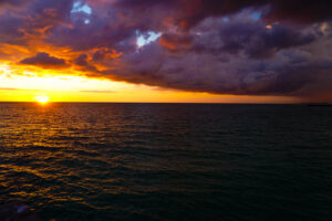
Sunset at Bradenton Beach. This is the Manatee County most people know. The river that runs through it meets Tampa Bay on a different shore.
But Manatee County is a place in its own right. The county has a large working agricultural interior, a fishing and boating shoreline, a historic river city, and conservation lands. Manatee’s significance does not depend on the reputation of its neighbors.
The Manatee River is the way I know to introduce this idea. It flows through the county’s interior and runs to Tampa Bay, past conservation land, through a city, and out along a mangrove-oriented shoreline, joining parts of the county that rarely get read together.
I start my initial journey at the point where the river gives itself to Tampa Bay.
Where the River Meets the Bay
De Soto National Memorial sits at the mouth of the river where the shoreline turns to tidal mangrove. The National Park Service made it a national memorial instead of a historic site because no one can say for certain where Hernando de Soto’s army came ashore in 1539. However, the mangroves’ roots hold the mud in place at the seam between freshwater and saltwater, and they are the last stretch of public land the river touches before the bay takes over. The water was calm here, as if it was paying its own homage to the heritage that exists on this land.
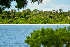
Memorial cross at De Soto National Memorial, taken from the trail on the other side.
One River, One System
Everything that sits upstream of that seam is one system. The Manatee River runs roughly 36 miles from eastern Manatee County to the bay, the collected runoff of a large inland landscape finding the low ground. Before it was a landmark, a name or a waterfront, its role was drainage: the way the wide stretch of land reaches the Gulf.
I intentionally begin with setting the physical scene because a place’s physical ground must be legible before its meaning can be. This is how I begin most documentary work. The projects to follow, from the working waterfront to the heritage communities and ranchlands, all belong to a person and a story. This one belongs to the river that they all share.
A City Built Around the Water
Upstream of the mouth, the river becomes a city’s organizing fact. From the riverwalk in downtown Bradenton you can witness the built environment and its connection to the river, from boats at the marina to the railroad, US-41 and Business US-41, two routes that exist largely to carry people from one side of the river’s banks to the other near Palmetto. The city of Bradenton arranged itself on this very river.
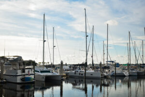
Recreational boats at the Bradenton Riverwalk marina. The working waterfront is a later chapter.
The Headwaters at Duette Preserve
If you follow the river inland, as the city and its suburbs fall away, you will find Duette Preserve, protected land of over 12,000 acres covering pine flatwoods, oak scrub, dry prairie, and depression marsh, holding the headwaters of the Manatee. The county manages it as the largest preserve in its conservation program. Florida scrub jays live there, and in 2024 a Florida panther was spotted and documented in the preserve for the very first time. The preserve also sits in the watershed of the reservoir that supplies public drinking water to county residents. The land at both the top of the river and the bottom belongs to the same system.
This is where the connection to the Florida Wildlife Corridor stems from. It starts upstream and travels down.
Angola and the Singing River
At Manatee Mineral Spring on Bradenton’s east side, a freshwater spring fed a settlement called Angola, a maroon community of people who had escaped slavery and built a livelihood along this water. Estimates had put its population at around 700, and archaeologists place it in the early 19th century until a raid in 1821 scattered its people, many of them toward the Bahamas. The only rigorous excavation so far has been confined to Manatee Mineral Spring Park, so the entire footprint of the Angola community is still unknown. The Riverwalk’s extension to the spring followed that archaeology. I photographed the Manatee from this end as well.
A local legend called the Manatee River the “Great River of the Mystic Music” after humming sounds said to be associated with the water. That folklore became the Singing River, and in the same park it now has a physical form: a sculpture of painted aluminum fitted with wind-driven sound devices with a panel that describes the movement of the river and its role as a place of gathering and reflection. It also stands at Manatee Mineral Spring Park where archaeologists have traced Angola.
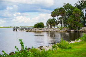
A pier and rock shoreline on the Manatee, with homes across the water.
What the River Carries
A river this long keeps several accounts all at once. Its headwaters are conservation land, its middle a river city, and its mouth a mangrove shoreline. The projects ahead will ask what the water carries and what it is asked to carry, and they will document who depends on the river for a living, what the land along it remembers, and what a growing county owes the place that supplies its water.
For now, I stand where the river is easy to see, working my way back toward where it starts. The headwaters project comes soon. This is Sacred Ground.
Ashton Stepter is the Founder of ASP & Co., a a place-based documentary and visual storytelling practice, and a Live Wildly Adventurist.